Large-scale maps
The Globe of Tekumel showing the northern continent and some of the southern bits
Map of the northern continent based on unwrapping the globe to a flat projection
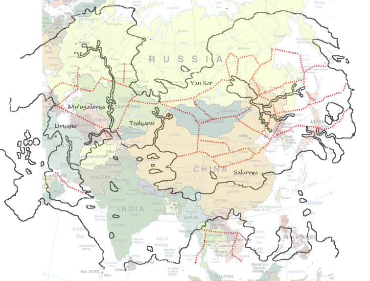
Comparison map between Tekumel's northern continent and Asia
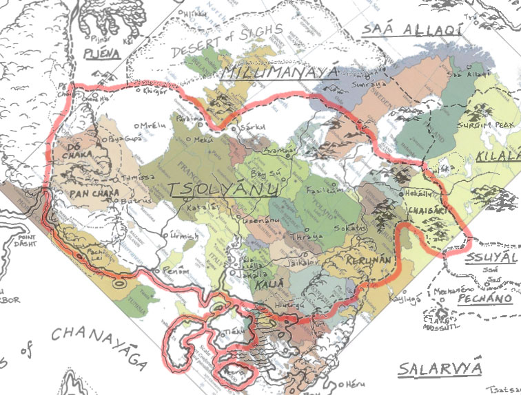
Comparison map between Tsolyanu and Europe
Cities
Tsolyanu
Tumissa in eastern Tsolyanu
Setnakh in southern Tsolyanu (description)
Fasiltum in eastern Tsolyanu
Thri'il in northern Tsolyanu
Bey Su in northern Tsolyanu
Hekellu in far eastern Tsolyanu, in the Chaigari Protectorate.
Another Hekellu map (and map key)
Usenanu article with map (central Tsolyanu)
Pala Jakalla article with map (southern Tsolyanu)
Butrus and Pan Chaka campaign, maps, and gazetteer.
Sa'a Allaqiyani
Sa'a Allaqiyor, the capitol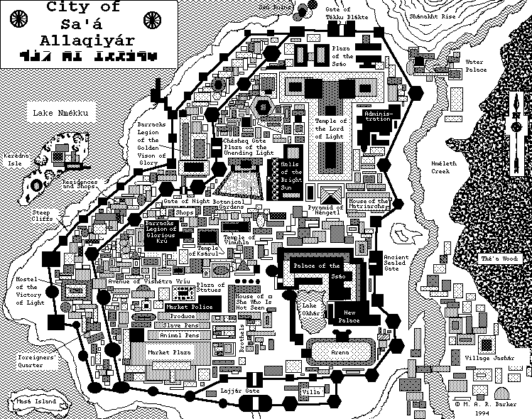
Kilalammu
Beautiful regional maps of Kilalammu.
Sirsum in eastern Kilalammu
Sirsum in eastern Kilalammu
Smaller Scale Maps
Sharu'una Fief article with map and gazeteer of Hekellu
No comments:
Post a Comment